
Publication of what many Bangladeshis viewed as a map of an "Independent Rakhine State" carved out of territory belonging to both Myanmar and Bangladesh prompted strong reactions on social media and concern among Bangladesh's strategists this week. On Sunday, the influential Buddhist monk Ven. U Kandala, believed to be an unofficial envoy of the Arakan Army, shared a map image on his Facebook page that included part of southeastern Bangladesh's Chattogram Division as part of an entity variously labeled as "Greater Rakhine" or "Independent Rakhine State."
Echoing a map circulated by the Arakan Rohingya Salvation Army (ARSA) in 2017 claiming Rohingya territory in Myanmar, Sunday's map dredged up historical disputes while raising questions about the future security and sanctity of Bangladesh's land border with Myanmar. The map is unlikely to be embraced by the AA commander, Twan Mrat Naing, as an official document. Still, rumblings on social media reflect anxiety in Bangladesh about the implications of territorial claims extending into its territory.
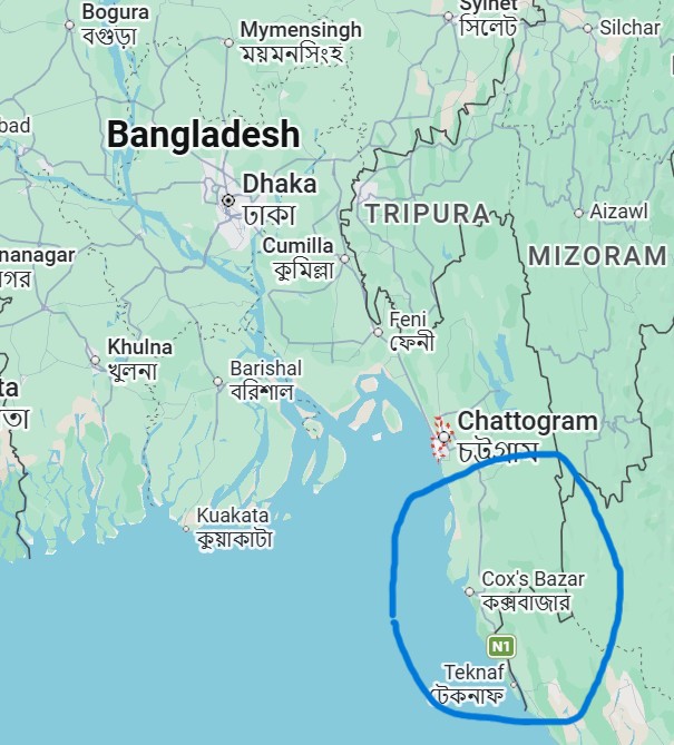
A map of an "Independent Rakhine State" shows the inclusion of parts of Chattogram
The Rise of the Arakan Army
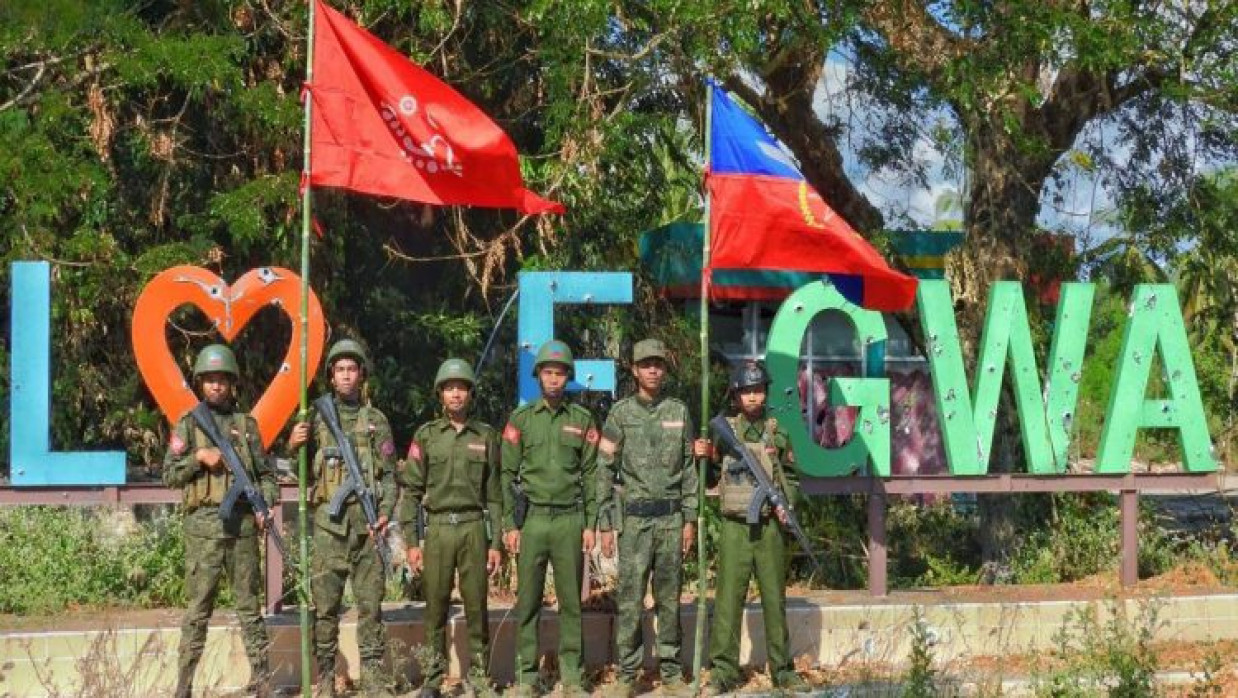
Over the last few years, the Arakan Army has developed into one of Myanmar's most powerful ethnic armed groups. Established in 2009, the Arakan Army began as a small insurgent group fighting for increased autonomy for ethnic Rakhine Buddhists. The power vacuum that emerged in Myanmar following the country's 2021 coup has allowed the AA to expand both militarily and politically significantly.
As of late 2024 and early 2025, the Arakan Army controls large swathes of Myanmar's Rakhine State, as well as most townships along the Bangladesh border. In Myanmar's countrywide anti-junta revolution, the Arakan Army made large territorial gains throughout "Operation 1027", bringing the insurgent organization to power over much of western Myanmar.
Now, the AA administers large swaths of territory, collects taxes, and governs border crossings. For all intents and purposes, Bangladesh now shares a border with the Arakan Army.
Historical Memories and the "Greater Arakan" Narrative
Publishing such a contentious map has resurrected old wounds. The proponents of "Greater Arakan" often refer to the lands that belonged to the Arakan Kingdom at times during the fifteenth to eighteenth centuries. The kingdom occasionally held sway over parts of southeastern Bengal as well, which included regions near present-day Chattogram.
But international law considers any claims to territory based on these past maps null and void. Bangladesh and Myanmar's current borders are well-established and internationally recognized. But history is often used for political purposes, not for geopolitics.
The map made Bangladeshis – especially those living in Chattogram and the Chattogram Hill Tracts feel that it was a call to reclaim what was once "Arakan", rather than an innocuous display of national pride. Bangladesh understands that map-launching has often been a prelude to border aggression elsewhere.
Bangladesh's Strategic Concerns
Bangladesh has already found itself grappling with the fallout from Myanmar's ongoing Rohingya refugee crisis. Over a million Rohingya refugees live in camps based around Cox's Bazar that they fled to following Myanmar's military crackdowns that began in 2017. Border instability would therefore be unwelcome news for Dhaka.
Bangladesh's relationship with the Arakan Army complicates matters further. Bangladesh and the AA have kept pragmatic communication channels open on issues related to border management and Rohingya repatriation, but suspicion remains on both sides. The AA has leveled accusations against unspecified Bangladeshi groups for allowing Rohingya militant groups like the Arakan Rohingya Salvation Army to operate from Bangladesh. Bangladesh fears Myanmar's civil war could spill over into its territory through arms smuggling, militant groups finding a haven in Bangladesh, or new waves of refugees fleeing across the border.
Publishing the map could not have come at a more sensitive time for Bangladesh. Decision-makers there will likely be concerned that hate-filled nationalist fervor being whipped up within Rakhine State emboldens extremist groups or further undermines stability along its border.
International Dimensions of the Crisis
However, this internal conflict in Rakhine State is no longer just Myanmar's civil war. The rivalry between regional and international players in Myanmar has increasingly become part of broader geopolitical contests.
China has billions of dollars in strategic investments at stake in Myanmar, including pipelines, ports, and other Belt and Road-linked infrastructure projects. China has a vested interest in Rakhine State and the port city of Kyaukphyu, which serves as a key outlet for Chinese transport routes linking landlocked southwest China to the Indian Ocean.
Meanwhile, rumors have emerged about potential unofficial communication between Western diplomats and the Arakan Army. While such meetings have neither been confirmed nor denied, if true, they would only demonstrate the desire of outside powers to better understand Myanmar's suddenly fragmenting political sphere.
For Bangladesh, this intensifies an already complex situation. Dhaka will have to walk a tightrope between keeping lines of communication open with China, dealing with the realities on its border with the AA, working with international NGOs to assist with humanitarian operations, and trying not to get too involved in Myanmar's civil war.
Risks of Escalation
Maps are powerful symbols. Cartography has been used throughout history to advance nationalism, mobilization, and psychological warfare. Despite the intentions of those who produced the provocative map of "Greater Rakhine," which were mainly aimed at internal nationalist consumption, the mere act of publishing it has diplomatic and security consequences.
Bangladesh will not accept the rhetorical questioning of its territorial integrity. Bangladesh's military and border guard forces are extremely sensitive to events on the southeastern border. Border deployment could be increased even further if any movement on the Myanmar side demonstrates expansionist tendencies.
Extremist sentiment could also spread on both sides of the border, increasing ethnic and religious polarization further. Bangladesh-Myanmar border regions are already some of South Asia's most fragile zones due to refugee camps, ethnic insurgencies, drug trafficking, and ongoing humanitarian insecurity.
A Region Entering a New Era
The Arakan Army's battlefield achievements have redrawn the political maps of western Myanmar. It is not yet clear whether the insurgents want complete independence, a federal arrangement, or significant autonomy for Rakhine State. But one thing is obvious: Bamar-dominated Myanmar's power politics no longer work as before in Rakhine.
It means that Bangladesh will have to engage with Naypyidaw and territorially powerful non-state actors who effectively control areas just across Bangladesh's border. It requires calibrated diplomacy, patience, and people-power on the ground along the frontier.
The infamous map may turn out to be nothing more than political rhetoric rather than pragmatic military strategy. But symbols do have real value in international relations. In a neighborhood already strained with festering memories of past injustices, refugees, insurgencies, and rival nationalisms, that one incendiary map may poison ties further and derail an otherwise stable bilateral relationship.
The ongoing Myanmar conflict is far from over. Bangladesh and the international community must keep a close watch on how events unfold there, as the future of Rakhine State will not only decide Myanmar's future but also the security equation of the Bay of Bengal.
0 Comments
LEAVE A COMMENT
Your email address will not be published