Louise Slater, University of Oxford; Abdou Khouakhi, Loughborough University, and Robert Wilby, Loughborough University
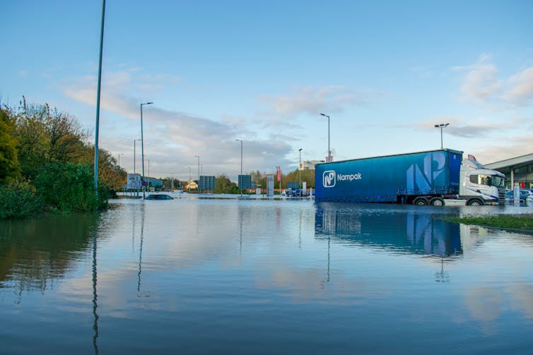
The rainfall that has inundated the North of England is the latest in a long line of flood events that are becoming the country’s new normal. Indeed, across the world, flooding is expected to become more frequent and more extreme as the planet heats up.
Building robust flood defences and modelling vulnerable areas is crucial if we are to avoid loss of life and livelihoods from these devastating weather events. But our new research reveals that the capacity of rivers to keep water flowing within their banks can change quickly – and in failing to acknowledge this, some flood models and defences may be under-equipped to deal with the consequences when they do.
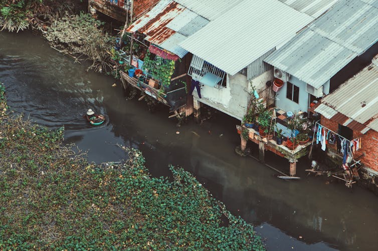
Many assume that flooding is due to heavy rainfall. This is true, but only part of the explanation. Floods also occur when the amount of water running off the land exceeds the capacity of rivers to carry that flow – as was the case when the River Don breached flood defences in the Sheffield area recently. So, floods are partly caused by the amount of rain falling, partly by the moisture that is already in the ground, and partly by the capacity of rivers to contain water within their channels.
This means that if the capacities of river channels change, then two identical rainfall events falling on similarly wet ground can cause flooding of very different severity.
Most rivers are forever changing. They are shaped by the sediments and water they carry. Humans have modified most of the world’s rivers in some way. In some cases this is through direct influence, such as dam construction or river engineering. Other influences are indirect – building on nearby land reduces the capacity of ground to absorb water, agriculture draws water from rivers, and deforestation leaves more water to flow elsewhere.
Rivers respond to changes in climate as well. During drier periods, less water flows through river systems. This means that there is often less energy to move the sediments at their beds, so riverbed levels may progressively rise, decreasing the capacity of the river. Abundant plant growth within the channel can also reduce a river channel’s capacity by slowing the flow.
But it is not always easy to predict how rivers will change. Extreme shifts in channel shape and capacity can occur very rapidly. After a recent flash flood in Spain, one river rose almost a metre as huge volumes of sediment from upstream were displaced and dumped further along. In tropical river systems, which tend to carry more sediment than temperate rivers, these changes can be several metres.
Uncertain risk
Unfortunately, such changes are typically ignored by flood engineers and modellers, who generally treat the channel as a fixed feature. If rivers actually change their capacity in space and time, then estimates of flood probability may be incorrect, putting people and property at risk.
Motivated by these concerns, we investigated the pace at which channel changes occur, and to what extent these alterations might be driven by climate. We began with a simple conceptual model: climate controls rainfall, rainfall affects river flow, and river flow shapes channel capacity.
Direct observations of this link were lacking in river systems over short timescales. So, we took 10,000 measurements of the capacity of 67 rivers in the US, covering a period of nearly 70 years. We also gathered rainfall and river flow data, to assess how climatic changes affected the capacity of the rivers.
We discovered that temporary shifts in river capacity, lasting years to decades, were far more frequent than had previously been assumed. Overall, river capacity tends to increase during periods that are wetter than average due to greater erosion of river channels, and decrease in drier periods.
We also found that multi-year climate cycles that affect regional precipitation patterns – such as the El Niño Southern Oscillation – can cause channel capacity to expand and contract too, perhaps on a global scale. Armed with this knowledge, we may eventually be able to predict how the capacity of rivers changes, and hence better understand flood risk.
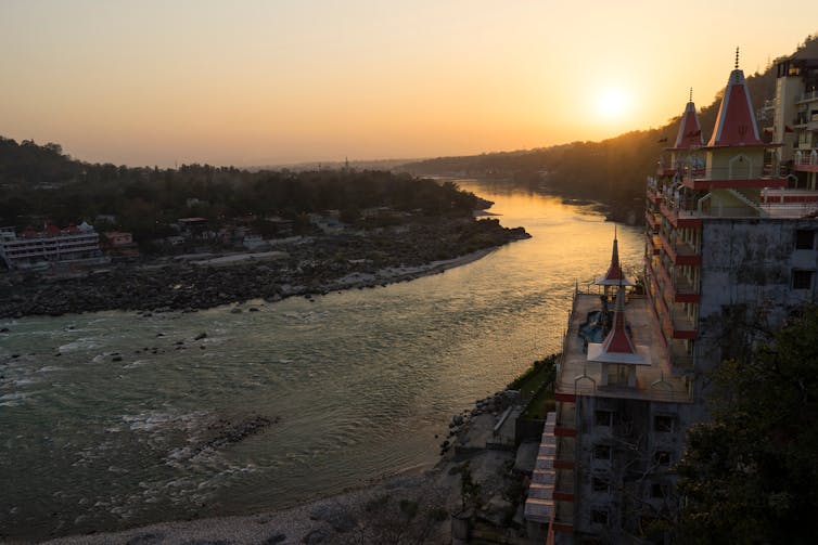
In temperate regions such as the UK, where rivers tend to be vegetated, heavily engineered and relatively stable, delicate changes in channel capacity are hard to detect and unlikely to be life threatening. However, in river systems that carry high volumes of sediment, or in parts of the world where rainfall varies considerably during the year, sudden reductions in river capacity may dramatically increase flood risk for nearby settlements. For example, the Ganges-Brahmaputra river in India and Bangladesh falls under this category. Its capacity is already changing, and its floodplains are some of most densely populated in the world.
Unfortunately, we still have very poor understanding of the nature and causes of channel capacity changes in most regions – and it is the most at-risk places that tend to have the least data. To better understand what’s happening, we need to use satellite imagery to monitor how fast rivers are responding to changes in the climate. What we can’t yet do though is monitor river adjustment in real time. Developing technologies that do this would greatly improve our understanding of how changes in river shape and capacity affect flood risk across the world.
Until this information becomes apparent, flood models and defence structures should build this uncertain risk into their designs. Doing so could make all the difference for those living in vulnerable areas.
Louise Slater, Associate Professor in Physical Geography, University of Oxford; Abdou Khouakhi, Research Associate, Climate and Weather Data Analysis, Loughborough University, and Robert Wilby, Professor of Hydroclimatic Modelling, Loughborough University
This article is republished from The Conversation under a Creative Commons license. Read the original article.