The changing landscape of the Brahmaputra River is clearly evident in the state of Assam in India. The river banks on both sides are inundated with large deposits of sand – an indication of desertification spreading throughout the region. Once famous for its abundant run off, the flow of the Brahmaputra is now reduced to a shallow level particularly in winter.
This growing desertification has become a big threat to the ecosystem in Tibet. It is assumed that moraine carried by water may create problems in dams in Tibet.
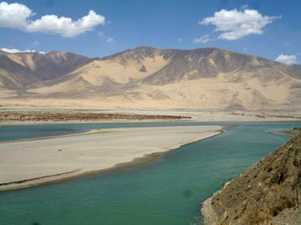
Yang Yong, a geologist from China said desertification has already started in the source of many rivers including Yarlung Tsangpo. The sand carried by the Tsangpo has turned many downstream stretches into sandy patches. The river has also become shallow and narrower at certain stretches.
The primary source of the mighty Brahmaputra river, the Jima Yangzong and Angsi glaciers, are retreating in Tibet, China, at an alarming pace.
In an interview Yang Yong, who is an adventurer also, said that if global warming continues at the current rate, the source glaciers as well as other glaciers located at the same height will disappear within few decades. The Jima Yangzong and Angsi glaciers give birth to the Yarlung Zangbo (Tsangpo)) and when it enters India it is called the Brahmaputra.
The melting of Himalayan glaciers threatens 1.3 billion Asians living downstream. It could bring drought and disease to large swathes of the continent. It is a matter of grave concern that almost 1,000 sq km area of Himalayan glaciers has disappeared from total area of about 5,000 sq km.
Yong, a scientist from Hengduan Mountain Research Institute and Deputy Director of Expert Committee of China Foundation for Desertification Control said the Jima Yangzong area at 5,500 meters has decreased substantially within last few years.
Like the Angsi and Jima Yangzong glacier, other glaciers which feed water to the Yarlung Zangbo are also melting and retreating rapidly.
It has been noted that the Himalayan region is warming about three times the global average with temperature increase of an average of 0.3 degree Celsius measured for the past half century.
The Nepal-based International Centre for Integrated Mountain Development (ICIMOD), which has conducted research on Himalayan glaciers for 30 years, warns of an urgent need for more research on the impact of climate change.
With changing temperatures, current trends in glacial melt suggest flows in major Asian rivers will be substantially reduced in the coming decades. The Siang (the main source of Brahmaputra) and other Himalayan rivers flowing through Assam likely to become dry in winter within another five decades if nothing is done about the soaring global temperature.
Fortunately, over the past four decades, the Shannan people have made achievements in desert control by building a 1.8-kilometer-wide “green Great Wall” that stretches 160 kilometers. More than 30,000 hectares of desert land in the middle reaches of Yarlung Zangbo River has been reclaimed.
*Chandan Kumar Duarah is a former Robert Bosch Fellow, an environmentalist and Guwahati based journalist.