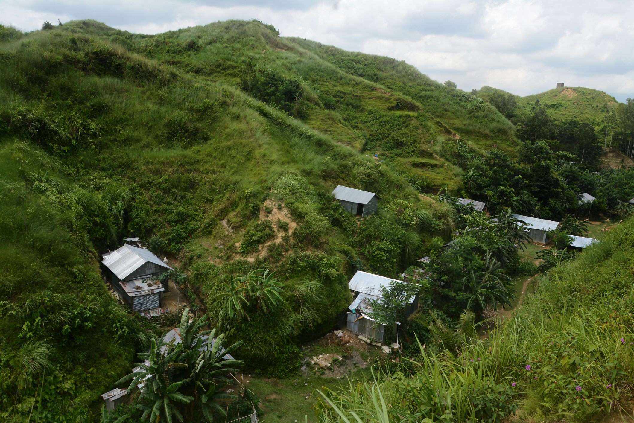
At the root of the tension in the Chattogram hill districts is the long-standing land disputes between the tribal and non-tribal people. The nature of land cultivation, ownership and possession is quite different in the hill districts from the rest of Bangladesh. There the tribal peoples are made up of more than 12 ethnic groups which have lived in the hilly interior uplands for several hundred years as ‘near-sovereignties’. The claims and counter claims over land are indeed more than a contest for a livelihood question. In fact, the shifting nature of Jhum cultivation has made the land question more complicated and contentious because of the collective sense of belonging is no longer sustainable in the current age of globalization and connectivity. Burning and slashing forest for Jum can’t effectively sustain the tribal economy—the need to justify diversity of economy—growing alternative and cash crops for which settler-tribal cooperation or side by side cooperative living is necessary. The land dispute can, by no means, be separated from the region’s peace and security issues. The Chittagong Hill Tracts (CHT) is composed of 10% of Bangladesh’s total land territory, and the three hill districts are the only areas where there is unused space for human habitation, agriculture and tourism industry.
Property disputes are a widespread phenomenon and have occurred across space and time. Ancestral property is extremely important because “a person is quicker to forget the death of his father than the loss of his patrimony”, said the Italian modern political theorist and diplomat Niccolo Machiavelli. Land is considered as an instrumental capital for enhancing both livelihoods and economic opportunities. But land loss, enclosures and dispossession have long been features of life in South Asia. Land disputes are socioeconomically and politically deep-rooted emotive issues.
The hill districts were self-governed traditionally and they used to pay an annual tax to the Mughal Emperor. During the British Period, the British took control of the hilly region in 1860 and recognized it as an area distinct from the rest of the country and demarcated as non-regulated area. Here it should be pertinent to mention that land related matters in CHT have always been distinct from other regions of Bangladesh. The British found the system of land tenure in the CHT was very different from their concepts of land administration, and hence they reshaped the system for their convenience of collecting land revenue. Therefore, some administrative and legislative reforms were brought through the Chittagong Hill Tract Regulation 1 of 1900.
Soon after its independence, the Government of Pakistan (1947-1971) took several initiatives to put its economy on the track of development. Industrial activities and massive infrastructural projects were launched across the country in general and in the CHT of East Pakistan (present Bangladesh) for its huge availability of natural resources. A hydro-electric power plant was constructed in the CHT region between 1959 and 1963. An embankment was built on the Karnaphuli River, and it created a lake occupying 256 square miles which was one of the erstwhile largest artificial lakes in the world and had great impact on the land management of the region. The barrage submerged 54,000 acres of agricultural land in the hill region, about 40% of the total cultivable land. Most of these lands were paddy fields. Besides losing the cultivable and homestead lands, more than 100,000 hilly people were displaced to evacuate the designated area. This is commonly known as ‘Bara Parang’ in the CHT. The trajectories of migration of the tribal people during 1960s and their endless sufferings are systematically documented in a couple of books entitled, Kaptai Badh: Bor-Porong and Between Ashes and Hope: Chittagong Hill Tracts in the Blind Spot of Bangladesh Nationalism, edited by Samari Chakma (2024) and Naeem Mohaiemen (2010) respectively.
Professor Angma Jhala in her 2023 research paper published in the Modern Asian Studies argues that the Kaptai dam project itself was positioned within the larger geopolitics of American military aid to Pakistan during the geopolitics of the Cold War period. While Pakistan had no significant output of industrial raw materials or a consumer market for high technology products, it was strategically important to the United States in advancing American policies to contain Soviet influence.
In the 1980s, extensive militarization took place to counter the armed insurgency in the region. As a result, the enlargement of the military and violence to the non-combatants in the hills, which drove the ethnic people to safer areas. The political unrest in the hills created the flows of internally displaced people (IDPs). There were at least four waves of Bengali-speaking immigrants into the hill districts: 60,000 came in the Pakistan era; 50,000 moved in the early years of independent Bangladesh, again 150,000 relocated throughout the Zia period; and finally, during Ershad regime, 241,000 settled in the hill districts. The tremendous rise of Bengali people into the hill districts made an unprecedented shift in the demographic and power structure of the entire hill region. Locals believe the occasional attacks on ethnic minorities in the hill districts are carried out as part of a larger ploy to grab the lands belonging to the ethnic people – an issue far too common in Bangladesh, a country facing a decades-old rift between the indigenous ethnic communities and the Bengali settlers. The strife between the settlers and the ethnic communities has a long and complex history that goes back to 1980, when landless Bengali families first began migrating to CHT en masse. Approximately 200,000 to 450,000 Bengali people were rehabilitated in the region between 1979 and 1985. The settlement of the Bengali people and acquisition of land led to the dispossession of agricultural workers, some of whom reacted violently. Both the Bengalis and the indigenous people are claiming the land for themselves, and both were doing so as nations.
The Chittagong Hill Tracts Land Dispute Resolution Commission Act 2001 set up a Land Commission, headed by a retired judge of the Supreme Court as its chairman to settle land disputes. The commission was formed in 1999 following the CHT peace accord in 1997. The government drafted the CHT Land Disputes Resolution Commission Act in 2001, and some provisions of the Act were amended in October 2016. The Land Commission consisted of a retired Justice, chairman of the RC or his nominated representative, 3 chairmen of the three District Councils, 3 Circle Chiefs and the Divisional Commissioner or his nominated representative. During the field survey to Rangamati, Khagrachari and Bandarban, we have found intense public dissatisfaction and anger regarding the non-functional aspect of the Land Commission.
Some local Bengali elites often put a great emphasis on the importance of administering a land survey as the first step to the resolution of land disputes. The peace accord also specified that a land survey is to be conducted after the rehabilitation of the Tribal refugees and IDPs. As said before, the Land Commission Amendment Act, 2016, was enacted to address the persistent land disputes in the CHT region. The functional procedures of the Commission are also affected by the amendments. Article 7 (3) introduces a potential procedural delay in decision-making, as fulfilling a quorum—requiring four out of five members to be present—may be challenging for various reasons. This requirement could hinder the timely resolution of disputes, prolonging the uncertainty and tension in the region. Furthermore, the amendment to Section 7 (5) stipulates that if a unanimous decision is not reached, the decision taken by the majority of members will be considered the Commission’s decision. This majority rule could lead to decisions that do not reflect the consensus of all stakeholders, potentially exacerbating existing tensions. One of the most contentious aspects of the amendment is Article 3(2), which specifies that there will be no Bengali representative in the Commission. This provision has been criticized for creating an imbalance in the decision-making process, as it ensures that tribal members will dominate the Commission. It is important to equip the Land Commission with modern logistic supports and resources. The task of coordination with various groups and agencies also needs to be heeded.
There are instances of indigenous resistance to the acquisition of land for infrastructural developments and tourism. A local resident said, “Recently, the government decided to mark one area as a large tourist zone by acquiring over 200 acres of land … many [Indigenous] people were going to lose their land. I heard that the government would try to appease them by offering jobs, giving them land in other places or by building them new houses … but they did not discuss their plan in detail with the local people [so it quickly escalated concerns] … so everyone protested”.
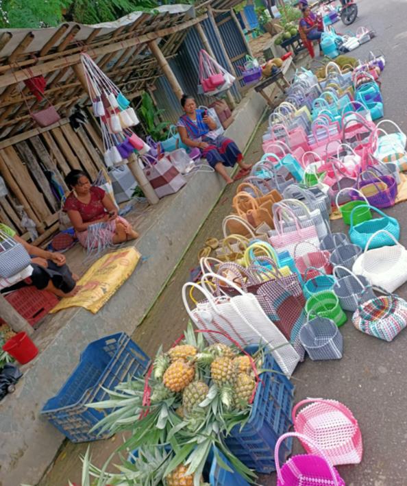
Figure: The author with his research team members has observed the local indigenous people selling agricultural goods and handy crafts (Source: Field survey, June 2024).
It is true that tourism development in the hill districts proliferated after the peace accord was signed in 1997. But tension in the hill hits tourism in several ways. The indigenous people sell oranges, pineapples, bananas, papayas, guavas, cocoanuts, lemons, jackfruits and watermelons to tourists. I have observed that some hill women sell their home-made handy crafts, indicating empowerment of the indigenous women. The tourism has thus become a source of indigenous employment and empowerment as well (See, the Figure).
Bangladesh tourism sector has a turnover of around TK 76,000 crore annually (Jagaran Chakma, Laltanlian Pangkhua’s report, Tension in the hills hits tourism, The Daily Star, October 12, 2024). The country boasts 30 tourist destinations with around 2.5 crore local people visiting the spots annually. Of domestic tourists, nearly 10 percent travel to the hill districts. Some local inhabitants in the hill districts perceive the development of the tourism sector as the subtle expansion of government structures and “settler colonialism” to occupy lands as well as repress the Jumma communities. The international actors, especially the NGOs still use the old Kaptai Lake issue to justify the tribal claim to the land and the “injustice” of the governments and the settlers. the dam and the lake have given alternative and sustainable means of living for the tribals and others. Kaptai now produces only a tiny amount of Bangladeshi power needs—more benefits go to the hill people—fishing, trade, tourism and of course to the settlers.
To conclude, there is little prospect of an easy and quick solution to the land conflict in the hill districts. The land conflict requires a thoroughly informed and well-crafted responses from the government, military, NGOs, civil societies, and Pahari stakeholders of Bangladesh and the adjacent region. The inevitable conflict could at best be managed—limited or contained, perhaps, but not resolved.